
Search a Roxbury Street Directory by Address
Work down a Roxbury street one parcel at a time. Start with the current delivery and parcel form, then preserve the tax year, district, block, lot, and owner result before opening a deed or historical source. This order prevents a name match from being mistaken for the same property. The Morris Tax Board, Morris GIS, Roxbury assessor, County Clerk, and library runs supply different pieces of the street-by-street trail.
- Normalize the delivery string with USPS, then retain the municipal situs address used by the tax and GIS records.
- Run the Morris County Tax Board Search Tax Records property-location mode and save the tax year, district, street, house number if used, owner, and parcel clues.
- Open the matching Morris GIS parcel to record block, lot, qualification code, PAMS_PIN, CountyID, MunicipalID, municipality, and tax-map page.
- Search the Morris County Clerk Records Vault by the owner and by parcel, map, or legal-description data to find recorded instruments.
- Use the address-oriented Morris County directory run for an older household clue, and compare it with census or newspaper evidence when the date matters.
Do not turn a voter or directory search into a street-wide roster. New Jersey voter access is limited by statute, and the library directories are historical, selective runs. The process identifies records tied to an address, not a complete list of everyone who may have lived nearby.
Roxbury Street Directory Address Forms
Keep three address forms in the research log. The USPS-recognized delivery address is useful for spelling and ZIP normalization. The municipal situs or parcel address is the physical location in tax, GIS, assessor, or deed records. A historical directory or post-office label can use a hamlet name instead. A current postal string can be correct for delivery yet fail to find an older Roxbury entry if the older volume used a community heading.
USPS offers address, city-and-state, and city-by-ZIP search modes. Its By Address route requires Street Address, City, and State, while company and unit fields are optional and ZIP can be optional. USPS specifically warns that a ZIP result does not confirm a person or company at an address. Use it to normalize the mailing string, then use tax and GIS records for parcel identity.
Note: Save the historic street wording unchanged so a later spelling update does not erase the clue that located the record.
Roxbury Street Directory Tax Board Fields
The Morris County Tax Board Search Tax Records is the first address tool for the Roxbury street directory workflow. Its live year and district choices are dynamic, so do not assume a fixed list. Each result should carry the tax year because owner and assessment fields can change. The visible modes offer address, owner, block-and-lot, and prior-block research rather than one general street browser.
| Field or mode | Type | Required | Roxbury street use |
|---|---|---|---|
| Tax Year | Selection | Yes | Dates the assessment result. |
| District | Selection | Yes | Chooses the municipal tax district. |
| Street Name | Text | Yes for property location | Finds the physical parcel by address. |
| House Number | Text | Optional | Narrows a street result to one location. |
| Owner | Text | Required in owner mode | Checks a listed tax owner against the parcel. |
| Block, Lot, Qual Code | Text or selection | Block and lot required; qualification optional | Tests parcel identity when the street wording varies. |
The Tax Board search form shows the property-location, owner, and block-and-lot modes.
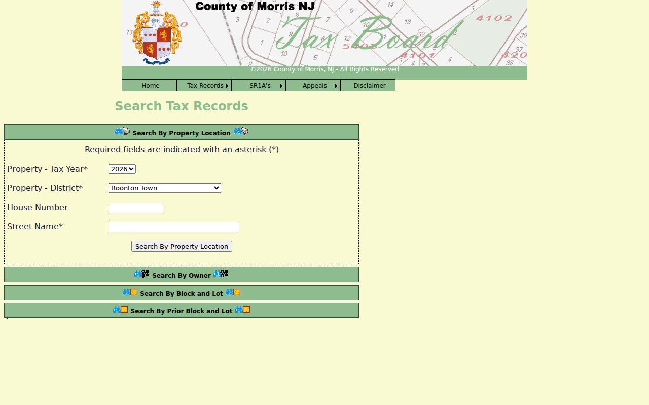
Use the form to reach a parcel record, then capture its identifiers before moving to the GIS map or deed index.
Roxbury Street Directory Parcel Clues
Morris GIS provides Parcel Searcher, Tax Search, Tax Map Viewer, and downloadable layers. The Parcel Searcher offers a map, geolocation, advanced data search, a buffer-in-feet control, and map identify functions. Its JavaScript-rendered search controls were not exposed in the inspected research, so no hidden field labels should be assumed. Use a map click or known parcel data instead of guessing an advanced-search syntax.
- Parcel
- A mapped property unit used to connect tax, map, and recorded-document research.
- Situs address
- The physical property location, distinct from the owner’s tax mailing address.
- PAMS_PIN
- An identifier shown on the inspected Morris parcel-card route alongside block, lot, CountyID, MunicipalID, and municipality.
- Plat or tax map
- A map-based property reference used for orientation and records research, not a replacement for a survey or legal description.
The inspected parcel card displays Tax Map Page, CountyID, MunicipalID, Municipality, Block, Lot, QualificationCode, and PAMS_PIN. Parcel polygons are explicitly not legal boundaries, tax maps, surveys, or legal descriptions. Use the card to establish a consistent parcel trail, then rely on deed and assessor material for a legal conclusion.
Roxbury Street Directory Records by Address
The Roxbury street directory is a chain of address-keyed sources, not a single database. The table separates the role of each source so that owner, parcel, recorded party, delivery form, and historical household are not merged. Where an online result ends, the documented counter, mail, library, or request route continues the research.
| Address record | Custodian | What it can show | Access route |
|---|---|---|---|
| Tax and parcel result | Morris County Tax Board | Tax-year parcel and owner clue | Property-location, owner, or block/lot search |
| Parcel map | Morris GIS | Parcel identifiers, map context, and nearby polygons | Public browser app and tax-map viewer |
| Recorded instrument | Morris County Clerk Records Vault | Parties, date, book/page, parcel, map, town, and legal-description data | Free public index, then counter or mail for older or copy needs |
| 200-foot search | Roxbury assessor | Formal notice-area request tied to property location and block/lot | Township form, mail or email delivery selection |
| Street-address directory | Morris County Library | Historical address-first household clue | Physical run, HM1 Nat, with 1977–2005/06 gaps |
| Voter-list route | New Jersey elections and county custodian | Limited public fields subject to statutory exclusions | Exact status search or statutory list route |
Roxbury’s assessor holds deeds, tax maps, ownership, and property-identification information and updates ownership after county deeds. That office can clarify a local tax-map or assessment question, but an assessor record is not proof that a listed owner lives at the parcel.
Roxbury Street Directory Deed Searches
The Morris County Clerk Records Vault search reaches recorded land records from 1960 forward online. The interface supports party name, instrument number, book/page, parcel ID, map and legal-description, town, lot/block, date, and related filters. Search the listed owner by party name and also test the parcel or legal-description fields. Party-name syntax uses Last-Name First-Name with no comma; initials and other variants may matter.
The County Clerk recorded-document index is the source for its document search interface.
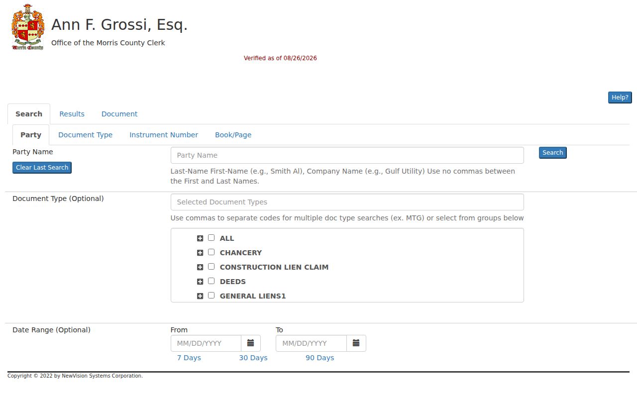
Record the document’s parties, instrument number, date, book/page, parcel clues, legal lines, linked documents, and image status before linking it to the street research log.
For pre-1960 transfers, use the Records Vault counter, mail route, and older index books. Index Book No. 2 covers 1841–1887, while the office’s land records reach to the late 1700s. Images may be restricted or require an account; certified and non-watermarked copy needs use the office route rather than an assumed online download.
Roxbury Street Directory Deed Result Checks
Do not stop at the search results list. The Clerk’s documented help material describes results paging, sortable or filterable columns, a Limit Search control, and document-detail tools. A document result can show direct or indirect parties, linked records, instrument number, date/time, recording book/page, consideration if shown, parcel or case information, legal description, map or lot data, and town or reference. Status other than V or B means an unverified record; R indicates replaced and C indicates correction.
Morris County Clerk search help describes the index results and document tools.
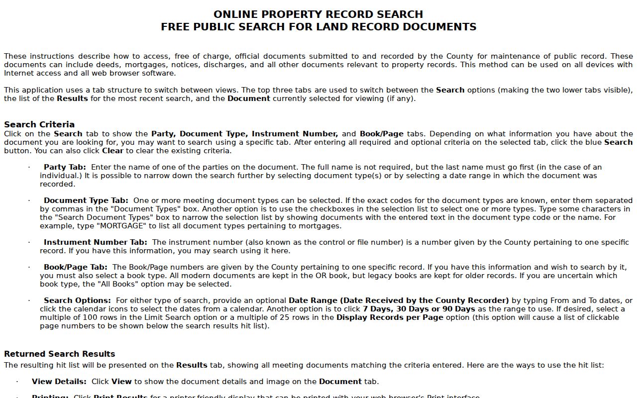
Use those fields to verify a document against the parcel record instead of relying on a name or street reference alone.
Roxbury Street Directory Map and Buffer Checks
A street can be checked parcel by parcel in GIS, but map proximity is only an orientation tool. Open the target parcel, use map identify to capture the record fields, and record nearby block/lot or PAMS_PIN values when the question concerns a small area. The Tax Board GIS Buffer List is another route. It requires Tax Year, District, Block, and Lot, with Qual Code optional. A buffer is a geographic shortlist, not a legal adjacency finding.
The 2024 Roxbury street map has a grid A–M and 1–5, a street-name index, a scale of one inch to 1,000 feet, and legends for government boundaries, roads, rail, and the Highlands Preservation Area. It is useful for locating an address form used in a directory. It is not evidence of parcel ownership, occupancy, or survey-grade boundaries.
Note: Morris GIS reported 2026 modernization and service-restoration work, so verify live map and buffer availability before treating an outage as a missing parcel.
Roxbury Street Directory Historic Labels
No official Roxbury street-renumbering, street-renaming, or annexation index was located in the inspected sources. Do not invent one. Instead, test the current street name, the municipal situs, the historical hamlet or post-office label, and the deed legal description. Historic Roxbury records may use Succasunna, Kenvil or McCainsville, Ledgewood or Drakesville, Lower Berkshire Valley, Landing, or Port Morris rather than the township name.
The town’s canal, rail, mining, and post-office history makes this step local rather than generic. The Morris Canal began in 1827, railroads expanded in the 1880s, and Lake Hopatcong’s gateway role grew by about 1890. A historical address can therefore be filed under a canal hamlet, rail stop, or nearby municipality. For the historical shelf itself, use the Roxbury Directory Book and preserve the volume’s heading in the address log.
Roxbury Street Directory Civic Record Routes
The New Jersey Voter Registration Status Search is an exact-match tool for a person’s own registration status, not a street-browse feature. It asks for last name, first name, and date-of-birth month and year. Hyphens, spaces, maiden names, and middle initials can affect a match. Public voter-list categories are limited by N.J.S.A. 19:31-18, and signatures, private identifiers, and covered-person home addresses are excluded. Polling locations and ward or district labels are useful civic geography, not proof of household membership.
For notice-area research, the Roxbury 200-foot Property Search form asks for block or lot, property location, requester contact details, and a mail, email, or both delivery choice. The form says to allow up to seven business days. It is a formal parcel-based route when a property-notice question cannot be answered from an online result.
Roxbury Street Directory Limits
A tax owner is not automatically an occupant. A tax mailing address is not the situs address. A deed party is not necessarily a current resident, and a historical directory listing is not a current roster. Keep the source role, record date, parcel identifiers, and any uncertainty together. NJ Address Confidentiality Program and Daniel’s Law protections, OPRA redactions, and voter-list exclusions may remove fields from otherwise public records.
Lawful street research. Use Roxbury street-directory records for family history, civic context, property curiosity, and lawful personal records research. Do not use them to track, threaten, harass, or harm any person.
The full named-street trail may require a current tax result, a GIS card, a deed, a library volume, and a custodian request. When these sources disagree, do not force a match. Return to the parcel identifiers and the dated document that best fits the question.