
Roxbury ZIP Code Coverage
Roxbury’s official assessment facts identify eight ZIP codes represented in the township and say that Roxbury has no ZIP code of its own. Some of the listed postal areas are only partly inside Roxbury. The table keeps the township’s official area labels separate from a municipal-boundary claim. Where the official street map identifies a local postal facility, that is stated; the remaining entries are postal labels, not a verified post-office location.
| ZIP | Areas Covered | Post Office | Notes |
|---|---|---|---|
| 07836 | Flanders postal area represented in Roxbury | Flanders postal label | Postal boundary is not the township boundary |
| 07847 | Kenvil community and postal label | Kenvil facility shown on the Roxbury street map | Represented ZIP, not a municipal boundary |
| 07850 | Landing postal community represented in Roxbury | Landing postal label | Coverage is not a township-wide claim |
| 07852 | Ledgewood community and postal label | Ledgewood facility shown on the Roxbury street map | Represented ZIP, not a municipal boundary |
| 07856 | Mount Arlington postal area represented in Roxbury | Mount Arlington postal label | Do not assume the entire ZIP lies in Roxbury |
| 07857 | Netcong postal area represented in Roxbury | Netcong postal label | Postal geography differs from municipal geography |
| 07876 | Succasunna community and postal label | Succasunna facility shown on the Roxbury street map | Represented ZIP, not a municipal boundary |
| 07885 | Wharton postal area represented in Roxbury | Wharton postal label | Do not treat the ZIP as a Roxbury limit |
The Roxbury assessment facts are the source for the eight-ZIP coverage. A municipal program can use a narrower administrative list than the geographic table. For example, the township camp information uses 07876, 07850, 07852, and 07847 as a general program set and directs people outside it to contact the office. That program rule does not shrink the full ZIP coverage table.
Roxbury Postal Geography
A ZIP code directs mail. A township boundary assigns municipal records. Those purposes differ, which is why the Roxbury ZIP code directory needs the full eight-row view rather than a single city-name shortcut. Flanders, Mount Arlington, Netcong, and Wharton are represented postal labels, while Kenvil, Ledgewood, and Succasunna are Roxbury community or post-office labels in the research. A search result may use one of those names even when the local question is about Roxbury Township.
The Roxbury street map offers a more useful municipal check after a postal result. Its street-name index and grid can help resolve a spelling that a mail tool does not recognize. For parcel work, the tax district, property location, block, lot, municipal ID, CountyID, and PAMS_PIN are stronger geographic anchors than a ZIP alone. This is the key local geography point: a recognized delivery name is not proof that an address lies wholly within the township.
Roxbury USPS ZIP Code Inputs
USPS supplies three useful forms of address normalization. By Address can return a ZIP from a street address and city/state. By City and State can return ZIP choices for a recognized city name. Cities by ZIP starts with the ZIP and returns recognized city names. These are delivery tools. USPS expressly says its result does not confirm that a person or company is at the address.
| Field label | Lookup mode | Required | Exact form note |
|---|---|---|---|
| Company | By Address | Optional | Company field is optional |
| Street Address | By Address | Required | Street address is required |
| Apt/Suite/Other | By Address | Optional | Unit field is optional |
| City | By Address; By City and State | Required | Required in both listed modes |
| State | By Address; By City and State | Required | Required in both listed modes |
| ZIP | By Address; Cities by ZIP | Optional by Address; required for Cities by ZIP | ZIP is optional only in the By Address mode |
Use the official USPS ZIP Code Lookup to normalize the mailing string before searching tax or GIS records.
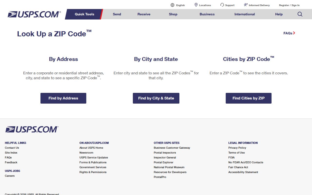
Once USPS returns a recognized address form, carry the street, city, state, and ZIP forward as input details. Do not carry it forward as proof of occupancy, ownership, or township jurisdiction.
Roxbury ZIP-to-Parcel Steps
The county property system does not offer a ZIP-first resident search. Its property-location mode works from tax year, district, street name, and an optional house number. That makes the ZIP code directory useful as a normalizing layer before, not instead of, parcel research. The following sequence moves from postal language to the record keys that Morris County uses.
- Use USPS By Address, By City and State, or Cities by ZIP to confirm the spelling and recognized postal city for the known address.
- Open the Morris County Tax Board Search Tax Records. Select the tax year and district, then enter the street name and, when known, the house number.
- Save the returned property location and tax-year details. In owner mode, the tool requires tax year, district, and owner. In block/lot mode, it requires tax year, district, block, and lot; qualification code is optional.
- Use the Morris Parcel Searcher to inspect the parcel and retain its municipality, block, lot, qualification code, CountyID, MunicipalID, and PAMS_PIN where shown.
- Contact the Roxbury assessor when a local tax map, ownership update, or property-identification clarification is needed. The county owner record is still not proof of a current occupant.
When the ZIP has narrowed the address to a particular street, the Roxbury street directory has the separate address-by-address record trail. The ZIP code directory stops at postal normalization and parcel identification, rather than turning a postal area into a list of residents.
Roxbury ZIP Code Search Limits
Not every local system accepts a ZIP field. The Tax Board uses tax year, district, house number, and street name in its property-location mode. The GIS Parcel Searcher has map, advanced-search, and buffer controls, but its detailed JavaScript-rendered input labels were not exposed in the inspected page. After a map identification, municipality, block, lot, and PAMS_PIN are the documented keys. A ZIP can guide the spelling and postal name, but it does not replace those fields.
The voter status form has no visible ZIP input. It requires an exact last name, first name, and birth month/year. County voter-list access is governed by statute and can include address or municipality information subject to its limits, but no current Morris County ZIP-filter request form was located. The state unclaimed-property form does offer city and ZIP fields, yet it is a limited owner-and-address clue, not a resident directory. Do not promise a ZIP field in a system unless its live form displays one.
Note: A ZIP code can improve an address search without establishing a person’s presence at that address.
Roxbury ZIP Code City Limits
Roxbury’s eight ZIP codes and its township boundary do not align. A location can carry a neighboring postal name while still needing Roxbury municipal or Morris County records, and a ZIP area can extend beyond Roxbury. The right response is not to guess from the city line in a mailing address. Check the township street map, tax district, property location, and parcel identifiers, then use the custodian whose records cover that parcel.
- ZIP versus ZIP+4
- A ZIP identifies a broad postal delivery area. ZIP+4 adds a more precise delivery segment within that system; neither is a municipal boundary.
- PO-box ZIP
- A ZIP used for post-office boxes. It identifies a mail service route, not the physical location of a person or parcel.
- Unique ZIP
- A ZIP assigned to one organization or high-volume destination. The research did not identify one for Roxbury, so it should not be assumed.
- Carrier route
- A mail-delivery grouping used by USPS. It may be useful for mail logistics but does not establish a legal parcel or township line.
Roxbury Postal Names in Records
Older material may be organized under a hamlet or post-office label rather than the modern township name. Roxbury’s historical communities include Succasunna, Kenvil or McCainsville, Ledgewood or Drakesville, Lower Berkshire Valley, Landing, and Port Morris. Try those labels in historical directories, newspapers, deeds, and postal searches when a known household does not appear under Roxbury. A directory may also use an initial, a spouse convention, or a slightly different street spelling.
This records geography comes from Roxbury’s history as a township of separate communities. It is useful for a family-history search because it broadens the place names tested without claiming a postal name is a current municipal boundary. The Morris Canal, rail, and mining history can also explain why an older deed or newspaper uses a community name that is missing from a modern ZIP result.
Roxbury ZIP Code Changes
The official township and USPS research supports the current eight-ZIP coverage and the boundary mismatch. It did not locate an official USPS or Roxbury bulletin documenting a ZIP split, realignment, or historical change date. That absence matters. A date should not be invented to explain an address mismatch, and a past postal arrangement should be tested against the record’s own date, street spelling, hamlet label, and tax or parcel evidence.
For a current address, refresh the USPS result and the municipal map. For an older record, preserve the ZIP or postal label exactly as printed, then compare it with directories, the street map, and the county parcel trail. Postal geography is a strong search aid when used with those records, but it cannot independently prove a city limit, a property owner, or a resident.